Home Practical info About Kotor Cruise and nautical tourism Cultural and historical institutions Kotor for Catalogues and brochures
Naslovna Home Prima

CRUISING AND NAUTICAL TOURISM

GENERAL INFORMATION

Geography

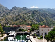
In the south-eastern part of the Adriatic coast, following the courses of the former rivers, the sea penetrated 28 km into the land, creating a unique bay, Boka Kotorska (86 km2), composed of two smaller bays, external Topla–Tivat bay and Kotor-Risan one.

Kotor is situated in the south-eastern end of the bay having the same name, on the site where the sea penetrated deepest into the land, with the following geographic coordinates 42°25 N and 18°47' E. The Town is located on the alluvial plain of the River Škurda, which flows alongside its northern walls, and the underwater spring of Gurdić which comes out next to its southern rampart. From the east overhang the slopes of Mount Lovćen, with St. John Hill (260 m), while to the southwest the sea connects it to the world. Kotor is reached by car, by bus, by ship and by plane – via the airports in Tivat (8 km), Podgorica (90 km) and Čilipi (73 km), or by train – via Bar (60 km). Kotor (6.633 inhabitants) is the seat of the municipality, cultural, educational, scientific, healthcare, commercial and sports centre. Kotor has the status of a permanent maritime border crossing and the port for international maritime traffic.

The Statute of the Municipality defined the boundaries for the area which, besides the Town of Kotor, include the settlements of Dobrota, Škaljari and Muo. Municipal sub-centres are Risan and Radanovići. Risan (2.092 inhabitants) is the oldest coastal settlement in the area. It performs administrative, educational, cultural, healthcare and tourist activities. It is on the crossroads on the road which leads to Nikšić.

Radanovići (650 inhabitants), performs administrative, educational, healthcare, commercial and sports activity.

Kotor municipality covers the area of 355 km2. Its area consists of three economic parts. Kotor-Risan Bay, mountainous hinterland (Krivošije Plateau, northern part of Njeguši village) and Grbalj Plain. There are 46 settlements in this area.

On the shores of Kotor-Risan Bay there is a sequence of settlements. On the eastern shore, there is Dobrota (7.313 inhabitants), the largest settlement in the Municipality, then Orahovac on the northern part of the coast, Perast and Risan on the north-western, and Strp, Lipci, Morinj and Kostanjica on the western coast. On the south-western coast there is a sequence of the settlements of Muo, Prčanj and Stoliv. These settlements are the home to 18.533 inhabitants. There are three dual settlements: Lower and Upper Orahovac, Lower and Upper Morinj and Lower and Upper Stoliv. The settlements in the mountainous hinterland, on Krivošije Plateau are the following: Dragalj, Zvečava, Ledenice, Knežlaz, Malov Do and Han, on Njeguši Plateau: Mali and Veliki Zalazi, and Mirac and Čavori below Njeguši Plateau. In these settlements there are 626 inhabitants. The following are the settlements in the Upper Grbalj area: Dub, Sutvara, Nalježići, Pelinovo, Šišići, Prijeradi, Bratešići, Gorovići and Lastva, and the following ones in the Lower Grbalj area: Lješevići, Vranovići, Pobrđe, Glavatičići, Kubasi, Kovači, Glavati, Zagora, Višnjevo and Krimovice.

The only settlement facing the deep sea, situated on 25.6 km long coast, there is a well-known fishing and tourist settlement of Bigovo. These settlements are the home to 3.000 inhabitants.

Climate

The area of Kotor and its surroundings have typical Mediterranean climate characterized by warm and dry summers, and mild and humid winters. Average annual temperature is 15.2° C. July is the warmest month with average air temperature of 24.1° C, and the average sea temperature of 23.0° C. Average air temperature in January is 7.7° C, and the average sea temperature is 13.1° C. Autumn is warmer than spring on average by 2.9° C.

On average, the longest duration of sunlight is in the settlements in the south-eastern part of the Lower Grbalj, Platamuni site in particular, while in Perast average duration of daylight is more than 7 hours and 30 minutes.

Average annual amount of precipitation in Kotor is 2.152 mm. The largest quantity of rainfall happens in autumn (248 mm) and winter (243 mm) months, while the summer months are the driest (68 mm). Precipitation level decreases going towards the southeast of the municipal territory.

The most frequent winds in Kotor are south-easterly and southern. There are quite a few calm days during a year (213), which makes still the surface of the sea.

In the period from mid-May to the end of the first decade of October the sea temperature exceeds the level of 18° C, which enables bathing season lasting for as many as 144 days.

The distance between the Port of Kotor and some important ports is as follows:

Kotor-Bar 42 Nm

Kotor-Bari 125 Nm

Kotor-Otrant 151 Nm

Kotor-Trieste 334 Nm

Kotor-Ancona 254 Nm

Kotor-Piraeus 715 Nm

Kotor-Dubrovnik 40 Nm

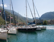
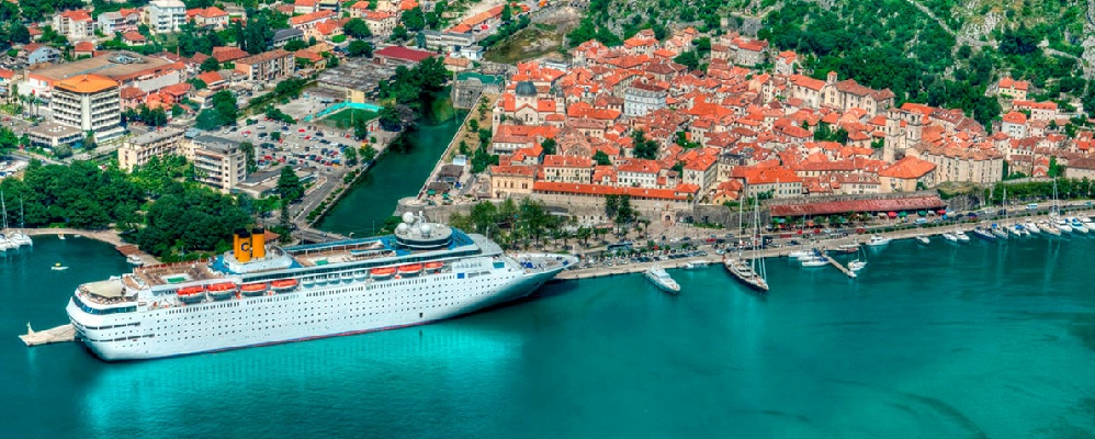
Kotor, and/or the Port of Kotor is situated directly alongside the Adriatic trunk road which ensures its connections with the coastal settlements and the towns and cities in the hinterland.

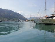
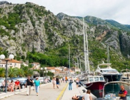
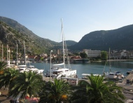
The length of the quay at the disposal of the Port of Kotor is 665m, out of which 512m is located in the western part and 153m faces the River Skurda. The quay can be functionally divided into five berths, as follows:

-Riva I, around 150m in length. This section is equipped with 11 bits.

-Riva II, a 100m in length. There is only a narrow stretch, 6 to 9 m wide, that vessels can use.

-Riva III, covers the southern section of the seafront, around 250m long.

-River I is located in the northern part facing the River Skurda in the length of around 80m.

-River II is a berthing area of around 70m long.

Both River I and River II are equipped with 10 respective bits. The entire quay is equipped with the total of 61 rubber fenders.

In the southern section of the quay, facing the sea there are connections for water, telephone and electricity, which are at the disposal of vessels.
Korisne informacije putnicima

u Kotoru


LUKA KOTOR

Park Slobode 1, 85330 Kotor, Crna Gora

tel: +382 32 325 573

fax: +382 32 325 573

E-mail: portofkotor@t-com.me


OPŠTE INFORMACIJE

Internacionalni poziv za Crnu Goru

00 382

Lokalni pozivni broj za Kotor 032


Pozivni brojevi za:

Tivat 032

Bar, Ulcinj 030

Herceg Novi 031

Budva 033


Službeni jezik: Crnogorski

Vrijeme (GM +/-): 1 sat

Prihvaćene kreditne kartice: sve

Udaljenost aerodrome od luke: 10 km

Prevoz: taxi, autobus


ATRAKCIJE

Zidine starog grada

Katedrala

Pomorski muzej


KORISNI BROJEVI TELEFONA:

Hitna pomoć : 124

Vatrogasci : 123

Policija: 122

Pošta: 301-038

Dom zdravlja: 325-633

Aerodrom Tivat: 671-336

Autobuska stanica:

Lučka kapetanija Kotor: 325-578

Republički hidrometereološki zavod: 1325

AMS: 19807

Ministarstvo turizma: 19817

TAXI: Red taxi 19719